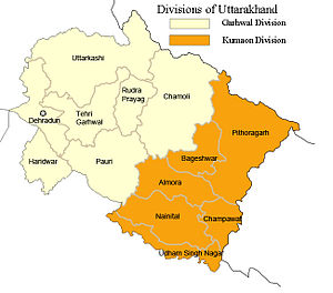
Uttarakhand has a total area of 53,484 km², of which 93% of total area is covered by mountain and 65% area is covered by forest . Maximum northern part of the state is covered by high Himalayan peaks and glaciers. Sub-divisions of Uttarakhand:
- Kumaon division
- Garhwal division
Roorkee city of Haridwar district is the part Garhwal division of Uttarakhand state and it is located at 29.87°N 77.88°E. Roorkee is 172 kilometers (107 mi) far from the Indian capital, New Delhi. Roorkee city is situated between the rivers Ganges, Yamuna, close to the foothills of the Himalayas. Before the creation of Uttarakhand on November 9, 2000, Roorkee was a part of the state of Uttar Pradesh.
Demographics
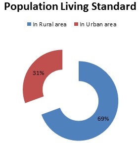
The native people of Uttarakhand are generally called either Garhwali or Kumaoni depending on their place of origin in either the Kumaon or Garhwal region. According to the 2011 census of India, Uttarakhand has a population of 10,116,752 comprising 5,154,178 males and 4,962,574 females, with 69.45% of the population living in rural areas. The state is the 20th most populous state of the country having 0.84% of the population on 1.69% of the land. The population density of the state is 189 people per square kilometre having a 2001–2011 decadal growth rate of 19.17%. The gender ratio is 963 females per 1000 males. The crude birth rate in the state is 18.6 with the total fertility rate being 2.3. The state has an infant mortality rate of 43, a maternal mortality rate of 188 and a crude death rate of 6.6.
According to India census 2011, Roorkee had a population of 2, 89,478. Males constituted 53% of the population and females 47%. Roorkee has an average literacy rate is 84.9%. Hindi, Urdu and Panjabi languages are spoken in the city.
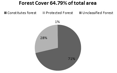
Forest Cover
As per the State of Forest Report 2005 the recorded forest area of the state is 34662sq.km, which constitutes 64.79% of its geographical area. By legal status reserve, forest constitutes 71.08% protected forest 28.51% and unclassified forest 0.41% of the total forest area. Major forest types occurring in the state are Tropical Moist Deciduous, Tropical Dry Deciduous, Sub Tropical Pine, Himalayan Moist Temperate, Sub Alpine and Alpine Forests.
Villages in Roorkee
| Villages Name | Block | District | State | Population |
| Padli Guzzar· Teli wala Gaon· Shakti Vihar |
Roorkee |
Haridwar |
Uttarakhand |
10875 |
| Salempur Rajputaan· Prem Nagar· Krishna Nagar | 8990 | |||
| Shahpur Saat-hapur | 1502 | |||
| Paniyala Chandapur | 9073 | |||
| Raheempur | 3867 | |||
| Mkkhanpur | Bhagwanpur | 1954 | ||
| Khanpur | 1619 | |||
| Sikenderpur Bhenswal | 7316 | |||
| Raipur | 2535 |
Transportation
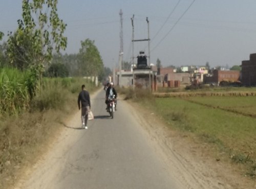
Roorkee urban area is well developed and transportation facility is easily available. In rural area transportation is also good. The Roorkee railway station is very close from the villages and bus station also near. Auto rickshaws, battery rickshaws and rickshaws are available in the village for easy transportation. Very traditional that is Bullock cart also use by the villagers for transportation of crops and row material from village to market. The villages are attached with the main roads and highways and in rural area roads are under construction or row roads (kacchi Road).
Jolly Grant Airport, Dehradun is the nearest airport from the Roorkee and Indira Gandhi International Airport in New Delhi is also near from the Roorkee city. Roorkee city is also connecting with the national highway.
Bus services are directed available from Roadways bus station for Roorkee to Delhi, Jaipur, Haridwar, Rishikesh, Dehradun, Chandigarh, Ambala Meerut and Muzaffarnagar. 24 hour bus service is available from Roorkee to Delhi.
Occupation
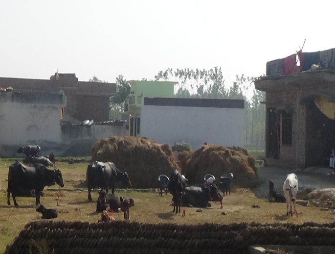
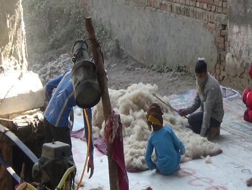
The main occupation is agriculture in villages of Roorkee. Some villagers work as a farmer on own land and some others work as a labour on others agriculture land. Jobs facilities are provided by the industries to the villagers. Small business and shops (car and motor cycle repairing shop, medical shop, kirana shop etc.) are established in the villages of Roorkee and Bhagwanpur block.
Small dairy is also run by the villagers. 20 to 30 cows are in dairy and milk is distributed in the villages. They also sale the cow-dung to the villagers for preparing the food and for other uses.
Divisions of Uttrakhand

Click on below buttons and Download PDF files for more details in this context.