The state of Rajasthan is situated in the western part of India, which faces severe water scarcity, poor rainfall, and is classified as arid/semi-arid region. On the basis of climatic conditions and agricultural practices, Rajasthan has been divided into 10 agro-climatic zones ranging from arid western to flood prone eastern. Rajasthan is the largest state of India, comprising 10.4 % of the country’s total area. Nearly 76% of the state’s population resides in rural regions. The forest cover of the state contributes 4.19% to the national forest cover. As much as 62,94,000 hectare of land is irrigated in the state, which is 10.45% of the net irrigated area of India and 38% of net sown area of the state of Rajasthan.
Rajasthan produces 5.49% of the nation’s total food grains production and 21.31 % of its oil seeds. The state has 49 million livestock—mainly cows, buffaloes, and goats—comprising 10.13% of the country’s livestock population. Administratively, the state comprises of 33 districts, 39753 inhabited villages, 249 Panchayat Samities and 9168 gram Panchayats.
Source: India State Forest Report 2011
Udaipur is a southern district situated among the Aravalli terrains which is rich of natural flora and fauna of Rajasthan. The district is oval in shape with a very narrow strip stretching towards the north. It lives between 23046 and 2602 north latitude and 730 and 74035 east longitude. It is bounded on the north by Ajmer district on south by Dungarpur and Banswara, on the east by Bhilwara and Chittorgarh and west by Pali and Sirohi district. The district cover an area of 17,279 Sq. Km and it measure 245 Km from north to south and 158 Km. from east to west. Administratively the district constitutes of 10 blocks and 11 development blocks i.e. Mavali, Gounda, Vallabhnaar, Bhinder, Kotada, Jhadol, Dariyabad, Sarada, Salumber, Kherwada.
Demographic profile
The total population of the state is about 56.5 million, 5.49 per cent of the country’s total population (Census, 2001). With 10.4% of the country’s geographical area, the region is sparsely populated with an overall density of population of 165 per sq. km. as compared to the country’s average of 313 sq. km. However, it varies greatly from as low as 13 per sq. km. in Jaisalmer district to as high as 471 per sq. km. in Jaipur district. The decadal growth rate recorded during the previous decade at 28.41% is higher than the national level of 21.5 % during the same decade. The region is predominantly rural with over 76% of the population belonging to rural areas. The number of females per 1000 males (sex ratio) in Rajasthan was 921 in 2001 and had shown an increase as compared to that in 1991 at 910.
Rainfall
The average rainfall of Rajasthan is 574 mm compared to the all-India average of 1,100mm and a significant variation is seen across different regions. In the western Rajasthan, the average annual rainfall ranges from less than 100 mm in northwestern part of Jaisalmer (lowest in the state) to over 400 mm in Sikar, Jhunjhunu, Pali region and along the western periphery of the Aravali range. In the eastern region, the rainfall ranges from 550 mm in Ajmer to 1020 mm in Jhalawar. In plains, Banswara (92.0cm) and Jhalawar (95cm) districts receive the maximum annual rain. The highest rainfall (1638 mm) is received at Mount Abu (Sirohi district) in the southwest region of the state.
Land Use pattern
| Land Use | Area in ‘000 ha | Percentage |
| Total geographical area | 34224 | – |
| Reporting area for land utilization | 34270 | 100.00 |
| Forests | 2728 | 7.96 |
| Not available for cultivation | 4265 | 12.45 |
| Permanent pastures and other grazing land | 1699 | 4.96 |
| Land under mics. Tree crops and groves | 18 | 0.05 |
| Cultivable wasteland | 4336 | 12.65 |
| Fellow land other than current fellows | 2108 | 6.15 |
| current fellows | 1565 | 4.57 |
| Net area sown | 17551 | 51.21 |
Topography
Rajasthan has varying topographic features though a major part of the state is dominated by parched and dry region. The extensive topography includes rocky terrain, rolling sand dunes, wetlands, barren tracts or land filled with thorny scrubs, river-drained plains, plateaus, ravines and wooded regions. In a more broad way the topography of Rajasthan can be divided in the following regions- the Aravalli or the Hilly regions, the Thar and the other arid regions, the Plateaus including Vindhaya and the Malwa, the Fertile plains including the Mewar, the Forest Regions and the Waterbodies including Rivers and Salt Lakes.
Forest area in Udaipur District
Total geographical area of Udaipur is 13419km2. 23.24% of geographical area is covered by forest in this district:
| Forest Type | Area cover (in km2) |
| Very Dense forest | 0 |
| Moderately Dense forest | 1420 |
| Open forest | 1698 |
| Total | 3118 |
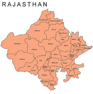
Map of Rajasthan

Click on below buttons and Download PDF files for more details in this context.